Tag: forecast
U.S. Tidal Floods Will Be ‘Chronic’ In 15 Yrs, Study Claims

U.S. Tidal Floods Will Be ‘Chronic’ In 15 Yrs, Study Claims

Washington (AFP) — Many U.S. coastal communities already struggle with flooding at high tides, a problem that will become “chronic” in the coming 15 years due to global warming, scientists said Wednesday.

As shorelines are growing more populated, sea levels are swelling due to melting glaciers and polar ice sheets, putting more populations at risk, said a report by the Union of Concerned Scientists.

Particularly dire consequences are expected along the U.S. east coast and the Gulf Coast, the report warned.

“Our analysis shows that increases in tidal flooding will be substantial and nearly universal,” said the report, based on tidal gauges in 52 coastal communities from the northeastern state of Maine down to Florida and along the Gulf Coast of Texas.

“That means the steady creep of sea level rise will force many communities largely unfamiliar with tidal floods today to grapple with chronic flooding in the next 15 to 30 years.”

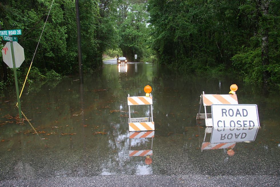
Scientists said the floods, while not catastrophic, could harm key infrastructure such as bridges and roads and cause property damage.

From 1880 to 2009, global sea levels rose about eight inches (20 centimeters). Today, oceans are rising at an even faster rate.

“No longer an intangible global trend, sea level rise has arrived on the doorstep of communities scattered up and down the east coast, delivered by the tides,” it added.

“In the next 15 years alone, two-thirds of these communities could see a tripling or more in the number of high-tide floods each year.”

– Big changes in mid-Atlantic –

The biggest changes are expected in the mid-Atlantic, said the report.

The U.S. capital, Washington, DC, and Annapolis, Maryland can expect more than 150 tidal floods per year by 2030.

In southeastern towns like Savannah, Georgia and Lewisetta, Virginia, “extensive flooding is expected to occur with tides alone on a regular basis within one or two decades,” said the report.

“By 2045, even more places can expect to see extensive flooding, including Ocean City, Maryland, and Myrtle Beach, South Carolina.”

In some places, the changes may be dramatic. For instance, the northeastern town of New London, Connecticut currently experiences tidal floods about twice per year, but that could rise to 35 in 30 years.

Spots along Texas’s Gulf Coast that rarely see tidal floods “could face 35 to 70 tidal floods per year by 2045,” the report found.

Some places, like Norfolk, Virginia, have put up tide gates to keep floods out of downtown business districts, but that’s not an option everywhere.

Miami, the world’s seventh richest city, is built on porous limestone and is already losing water wells to incoming saltwater. The city of 417,000 faces more frequent flooding of business and residential areas.

“By 2030, Miami can expect the frequency of tidal flooding to increase nearly eightfold — from about six per year today to more than 45,” said the report.

“And by 2045, the city can expect more than 40 times as many floods as today.”

New Jersey’s coastal resort towns and gambling haven of Atlantic City — which were battered by Superstorm Sandy in 2012 — are also forecast to see floods up to 90 times a year by 2030, and 240 annually by 2045.

“Such unrelenting disruption could radically change the South Jersey Shore as a place to live and play,” said the report.

– ‘Dangerous’ climate change –

The problem is not new, and some east coast communities have already seen “a fourfold increase in the annual number of days with tidal flooding since 1970,” it found.

Solutions adopted by some coastal communities involve a combination of defending against the rising waters, accommodating them or retreating from them.

The report urged world leaders to take the threats seriously and plan ahead, but also to cut back on burning fossil fuels that lead to global warming.

“Global emissions are rising rapidly, and are on a trajectory to push surface temperatures more than 2 Celsius (3.6 Fahrenheit) above the pre-industrial average — the threshold beyond which scientists say ‘dangerous’ climate change becomes unavoidable,” said the report.

“To stay below this threshold, and slow the rate of sea level rise later this century and beyond, global carbon emissions need to peak and begin to decline by the end of this decade.”

Photo via Florida Fish and Wildlife via Flickr

Interested in more national news? Sign up for our daily email newsletter!

Hurricane Forecasters Will Map Potential Storm Surge

Hurricane Forecasters Will Map Potential Storm Surge

By Kevin Spear, Orlando Sentinel

ORLANDO, Fla. — Starting this year, national hurricane forecasters will issue maps showing where there’s potential for storm-driven seawater to charge miles inland to flood streets, knock down homes and kill people.

The new online map will appear on the center’s website when a watch is announced for a hurricane and for some tropical storms.

It is being showcased this week at the National Hurricane Conference in Orlando as an overdue service only now having the technology to perform reliably despite the variable nature of hurricane season from June 1 to Nov. 30.

“It has to perform well under all conditions,” said Jamie Rhome, storm surge team leader at the National Hurricane Center. “It can’t perform well in one storm and not the next storm.”

Storm surge is the seawater pushed by a hurricane against a coastline, providing a liquid runway for battering waves to demolish beaches, bridges, buildings and, in the worst cases, nearly any recognizable part of a community.

As with other aspects of hurricanes, predicting a surge of seawater is complex and depends on a storm’s intensity, speed, size, angle of approach to the coast and coastal characteristics.

Using a color key, red would represent areas expected to be covered with more than nine feet of water above the ground; orange would indicate a depth of six feet or more; yellow would show inundation of at least three feet; and blue would indicate up to three feet.

It’s meant to be a visual showing of where to expect a hurricane’s greatest threat to people and their property. But in 2015, the center will also issue warnings, indicating in blunt terms where seawater could cause death and destruction.

“A warning is the National Weather Service’s most explicit way of communicating life-threatening flooding,” Rhome said. “We are saying if you are in this warning area, you need to take action immediately to protect your life.”

Though all of Florida is vulnerable, conditions along the state’s west coast could help propel a storm surge 30 to 40 miles inland, particularly along rivers.

The primary factor that makes the Gulf of Mexico coast conducive to fearsome surges is the shallow water that extends for many miles into the gulf.

Less vulnerable is a portion of Southeast Florida, where the seafloor has a sharper drop-off that can inhibit storm surge.

Emergency responders at the conference welcomed the new online tool, though it has not yet shown what it can do in action.

Michael Whitehead, mass care coordinator with the Florida Department of Business & Professional Regulation, said hurricanes have the multiple threats of wind, tornadoes, flooding and storm surge.

“Saying that a hurricane is going to be Category 4, for example, doesn’t tell you what the hazards will be,” Whitehead said.

Eric Flowers, spokesman for the Indian River County Sheriff’s Office, hadn’t yet heard much about the storm-surge map but predicted it would make a difference.

“If it gets more information to the public, that’s fantastic,” Flowers said.

Rhome said Florida’s west coast is little familiar with storm surge. The last bad one was nearly a century ago, he said.

Experience elsewhere in the state includes Hurricane Frances, which hit Florida’s Treasure Coast in 2004 and smashed inland marinas in Fort Pierce into piles of splintered docks and wrecked boats.

Weeks later, Hurricane Ivan flooded downtown Pensacola with storm surge that also savaged many communities on barrier islands along the western Panhandle.

A year later, Hurricane Dennis shocked coastal residents south of Tallahassee when as much as 9 feet of storm surge pushed well inland, though the storm itself struck land far to the west.

Elsewhere in the nation, storm surge from Hurricane Katrina in 2005 wiped out communities in Mississippi with 25 to 28 feet of onrushing seawater.

Rhome said the surge maps will be informative, but coastal residents need to know their neighborhood’s designated storm-surge evacuation zone, which is ranked from the most vulnerable A zones through the least vulnerable E zones.

The “public” tab at floridadisaster.org is one way to learn about evacuation zones.

“I’d have to say that 10 percent of the population knows their evacuation zone, which is way too low,” Rhome said. “How could you possibly know what action to take in a hurricane if you do not know your evacuation zone?”

Photo: acccarrino via Flickr