Tag: earthquakes
LA, On Cusp Of Controversial Quake Retrofit, May Want To Follow SF’s Blueprint

LA, On Cusp Of Controversial Quake Retrofit, May Want To Follow SF’s Blueprint

By Rong-Gong Lin II and Rosanna Xia, Los Angeles Times (TNS)

SAN FRANCISCO — The rental market here was already under siege when city officials began an ambitious earthquake retrofitting project whose costs will largely be passed on to renters.

Fueled by the city’s tech boom, rents have soared, with average one-bedroom units going for $3,500 a month. Low-income tenants are being evicted as a large number of apartments are being taken off the long-term rental market to be turned into condos or leased to users of Airbnb and other short-stay leasing services.

But the anger over the situation hasn’t extended to the earthquake-retrofitting law, even though the $60,000- to $130,000-per-building price tag will be largely paid for through rent increases over the next two decades.

Renter advocates say the costs are an added burden. But they acknowledge that in return, tenants will get something essential — protection from a type of building that has collapsed and killed residents in California’s last two major earthquakes.

“We are in the middle of an earthquake zone, and tenants deserve the certainty of safety when a natural disaster hits,” said Sara Shortt, executive director of the Housing Rights Committee of San Francisco.

The reaction in San Francisco is instructive as a Los Angeles City Council committee Wednesday considers an even more ambitious retrofit law.

Los Angeles’ law would require as many as 13,500 quake-vulnerable wood-frame apartments to be strengthened, compared to 5,000 in San Francisco.

The law proposed by Mayor Eric Garcetti would also mandate retrofits of as many as 1,500 brittle concrete buildings, a problem San Francisco has not yet addressed.

If passed, Los Angeles’ law would be the most sweeping seismic safety measure passed in California history.

The cost to renters has emerged as a big political issue. While not as bad as San Francisco, Los Angeles is one of the most unaffordable cities in the nation for tenants, where the average one-bedroom rent is nearly $2,100, according to Real Answers, a rental research business.

Existing law allows Los Angeles to follow San Francisco’s lead and allow owners to pass on all costs of mandatory earthquake retrofits to tenants through a rent increase of as much as $75 a month.

But after much study, Los Angeles housing officials proposed a 50-50 split — owners and renters would each pay half the costs, with a rent increase capped at $38 per month. (By contrast, rents in San Francisco can go up 10 percent every year until the tenant is paying the full cost.)

City officials are also looking for other ways to help. Garcetti supports state legislation that would allow owners to apply for a tax break equal to 30 percent of the retrofit costs. The bill, AB 428, passed the state Legislature in September but needs Gov. Jerry Brown’s signature. Owners have also sought more financial aid, like a reduction in property taxes and expensive building-permit fees.

Renter advocates in L.A. remain concerned about how much tenants will have to pay, and said they will fight the retrofitting law if the financial arrangements aren’t fair.

“While we do support making these units safe, it can’t be on the backs of those least able to pay,” said Larry Gross, executive director of the Coalition for Economic Survival.

Costs have long been the big barrier to requiring owners to act. But over time, mandatory retrofitting has taken hold in a few cities.

The Silicon Valley suburb of Fremont was one of the first cities in California to make a big push in retrofitting wood-frame apartments. Sixteen years later, there’s only one building left to upgrade, said Jeff Schwob, the city’s community development director.

Berkeley began slapping more than 320 quake-vulnerable buildings with warning signs in 2005, and instructed owners to tell tenants that their apartments could pose “a severe threat to life safety.”

More than 100 were retrofitted voluntarily, and Berkeley then ordered the remaining buildings to be retrofitted.

“So much of Berkeley is controversial, but this one kind of really went through without a whole lot of opposition,” said Eric Angstadt, the city’s planning and development department director. “I think everybody generally thinks it’s a good idea to have seismic retrofits for these types of buildings.”

The threat of wooden apartment buildings has been known for years; collapses killed at least three people in San Francisco during the 1989 Loma Prieta earthquake and 16 people in an apartment building in the 1994 Northridge earthquake.

Backers of retrofitting told tenants that rent increases are a small price to pay. A major quake in San Francisco, they said, would destroy many apartments that would be replaced by new dwellings not covered under rent control.

For owners, retrofits will protect against costly lawsuits if a collapsed building injures or kills people, and keep rent checks flowing after a quake strikes.

“It’s work that needs to be done,” said Janan New, executive director of the San Francisco Apartment Association.

Some owners have quickly moved to begin retrofits. Since San Francisco passed a mandatory retrofit law in 2013, owners of more than 270 buildings have finished retrofits for 5,058 vulnerable structures across the city, years ahead of deadlines to complete construction.

Owners of more than 660 other buildings have applied for or received building permits for retrofit construction.

So far, most building owners have complied with the mandatory retrofit deadlines. Owners who miss deadlines have had provocative signs posted on their buildings by city officials that say “Earthquake warning!” in large red letters, set over an image of a collapsing building.

Last year, more than 400 buildings were marked with the warning signs after missing a deadline to turn in a retrofit screening form. As of last week, only three remain.

“It was amazing. It worked really fast,” said Patrick Otellini, who heads San Francisco’s earthquake safety program. These signs “actually said something to tenants that live in these buildings.”

Neither owners nor tenants were thrilled initially at the prospect of retrofits. After opposition, city officials made it easier for low-income residents to request an exemption from the retrofit rent hike.

Seismic retrofits are now seen as a regular cost of business. “As a landlord … you have a responsibility to make sure you’re housing people in a safe place,” Otellini said.

Retrofitting a building was considered optional and too costly in the past, but now, “it’s almost becoming politically incorrect to talk about earthquake safety in that way,” Otellini said.

Some owners who have completed retrofits have already received approval for rent hikes. In one nine-unit building in the Sunset District, the San Francisco Rent Board approved a monthly rent increase of about $62 to cover the expenses of a $99,000 retrofit and interest.

If the Los Angeles housing committee passes the legislation Wednesday, it could be considered by the full City Council as early as Friday.

Some Los Angeles renter and owner groups have objections to the legislation, including a concern that four years is too little time to get wooden apartments retrofitted.

The mayor said there should be no delays.

“Every month we wait is a month that the Big One could hit,” Garcetti said. “And we would look back and say, if we had just done this a little more swiftly, lives and properties would’ve been saved.”

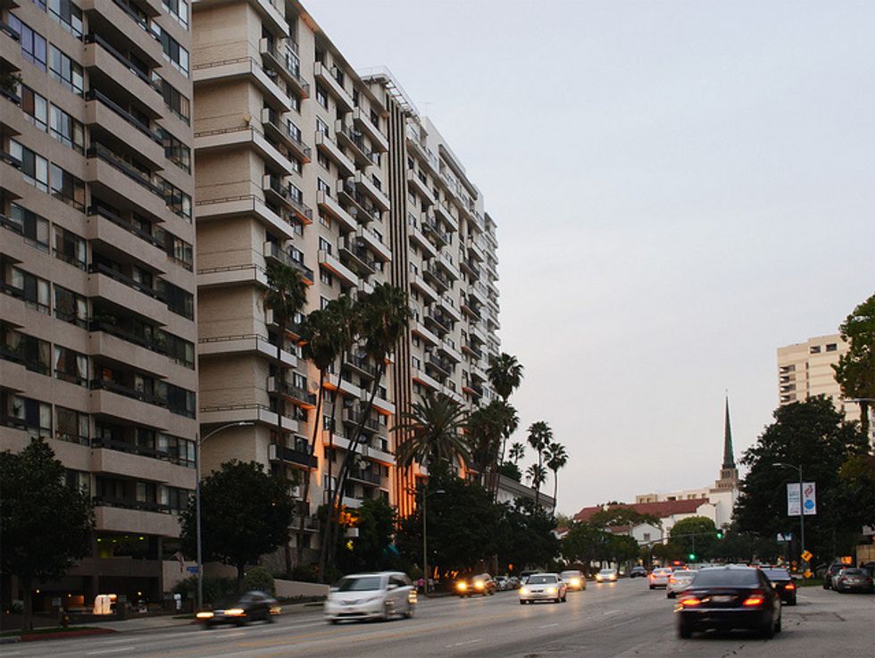
Photo: Apartment buildings in L.A., like this high-rise off Wilshire Boulevard, might be subject to stringent retrofitting rules to make it safer in case of earthquakes. InSapphoWeTrust/Flickr

Scientists Look For What’s Causing Texas Earthquakes

Scientists Look For What’s Causing Texas Earthquakes

By Anna Kuchment, Randy Lee Loftis, James Osborne, and Avi Selk, The Dallas Morning News (TNS)

DALLAS –– Swarms of small quakes rippled up from unknown faults beneath the soil. They rustled Cleburne, Azle and Irving. Fifteen recent earthquakes around the old Texas Stadium in Irving site included the strongest yet in Dallas County, and their waves shook downtown office towers.

But after six years and more than 130 quakes, scientists are just beginning to map the fissures beneath Texas,. figure out why they woke up and predict what they might do next.

No one knows for sure whether the quakes are signs of a geological realignment, the aftermath of gas drilling or something else entirely.

What lies under Irving? That may be the biggest mystery facing the team of scientists investigating the latest earthquake swarm to hit North Texas.

“There are no known faults near the earthquake site,” said Beatrice Magnani, one of nine Southern Methodist University researchers studying the quakes.

That means about three dozen quakes that have rocked Irving since April are coming from a previously undiscovered fissure, deep underground.

“In this area of the world, researchers don’t know a lot about these faults, because the faults don’t come to the surface,” said Heather DeShon, a seismologist with the university.

Science can tell us only so much. Geological earthquake records are spotty before 1970, though they show no evidence of anything like the current spate in North Texas history.

And it may be impossible to predict how long the current rash of quakes will last. The Azle area got 27 quakes over three months. Cleburne was hit by two clusters, in 2009 and 2012.

But without knowing the size of the fault under Irving, scientists have no way to tell whether it might one day produce a devastating quake — something thousands of times more powerful than the 3.6-magnitude earthquake that struck last week. (Scientists say the majority of earthquake swarms do not culminate in large, damaging events.)

To that end, the SMU team is trying to pinpoint each new quake and use the earthquakes’ locations to map the Irving fault’s size and depth.

The team is also trying to figure out which of several nearby fault systems Irving’s fissure belongs to. To the west, a system of small, deep faults has been linked to previous quakes in Azle, Cleburne and Dallas/Fort Worth International Airport. In the east, the large Balcones and Ouachita fault systems wind south to the Gulf of Mexico and beyond.

The U.S. Geological Survey, which monitors and locates earthquakes across the world, places most of Irving’s quakes near the former Texas Stadium site. With sparse equipment near the quakes, the agency’s estimates can be off by miles. So last week, the SMU team added nearly two dozen seismometers — quake detectors — in and around Irving.

The team has also asked the Texas Railroad Commission and energy companies to help them gather information.

“Since the oil and gas industry are actively drilling into those rocks, they tend to know more than we do about subsurface fault structure,” DeShon said.

But the team has another purpose in investigating nearby gas wells and wastewater wells: to see whether underground pressure changes related to those wells are significant enough to cause quakes.

Almost as soon as earthquakes began rattling North Texas, fingers pointed at the hydraulic fracturing, or fracking, boom that has overtaken the state this past decade.

The Texas Railroad Commission’s newly appointed seismologist, Craig Pearson, quickly dismissed any connection to oil and gas drilling. But the SMU team isn’t so sure.

“Obviously, we’re in the Fort Worth basin. We have to look into production activities and also wastewater injection activities,” DeShon said.

For decades, research has linked earthquake activity to underground injection wells, used by oil and gas companies to dispose of the large volumes of brackish water that are a byproduct of oil and gas drilling.

An injection well can reach more than 10,000 feet deep, pumping tens of millions of gallons of untreated water a year into underground rock formations and sometimes the faults that cause earthquakes.

That rush of liquid can stress the faults, setting off a chain reaction that can make buildings shake.

Since 2008, the SMU team has linked the Cleburne and airport quakes to injection-well activity.

But with Irving’s quakes, there’s some skepticism about whether injection wells are to blame.

Two injection wells lie under the airport, up to ten miles from the center of the latest quakes. While one study in Oklahoma found that injection wells could cause quakes as far as 21 miles away, most studies link earthquakes to injection wells no more than six miles away.

“You can never say never, but it doesn’t seem like a smoking gun,” said Cliff Frohlich, a University of Texas at Austin seismologist and one of the foremost experts on Texas earthquakes.

But that is not the only line of inquiry directed at the oil and gas industry.

Recent research has linked earthquakes to fracking itself — a process where water and chemicals are pumped underground at high pressure to create small fissures in rock that release oil and gas.

Scientists at Miami University in Ohio published a paper tying natural gas wells there to a quake in a previously unknown underground fault that registered magnitude 3.0.

In North Texas, the closest wells are about two miles northwest of the epicenter of the Irving earthquakes. They are operated by Fort Worth-based Trinity East Energy.

There are nine more within about seven miles of the quakes, according to data from the Texas Railroad Commission.

According to Trinity East President Steve Fort, the two closest wells were last fracked about five years ago.

That would make them an unlikely cause, said Steve Horton, a seismologist at the University of Memphis.

But with many questions and little in the way of explanation, scientists are digging through those and other drilling records and studying fault maps looking for a connection.

They expect solving the riddle to take months — and they’re only just getting started.

“It’s like cancer,” Frohlich said. “You can never really prove someone got lung cancer because they smoked. All you can do is look at the statistics and say you’re more likely to get cancer if you smoke.”

“In 1902, there was a big earthquake in Austin,” he said. “You know that wasn’t fracking. But if it happened at D/FW airport tomorrow, you’d wonder if it was.”

Besides drilling activity and natural shifts in the bedrock, at least one other theory intrigues some researchers: Could the long Texas drought have sucked enough water from the ground to destabilize the fault?

A gallon of water weighs a bit over eight pounds — whether it’s in a jug or in the ground.

Multiply that by thousands of square miles, years of scorching heat, and millions of thirsty residents. A drought can reduce the force of gravity over a fault zone — potentially causing the Earth’s crust to bounce up and trigger earthquakes.

In theory, anyway. And local data appear to pour cold water on that theory.

Much of the state has been in a drought for years, yet only a few places have had earthquakes.

What’s more, drought or no drought, groundwater pumping in urban North Texas is minuscule — seemingly not nearly enough to tip the balance toward earthquakes.

The water that comes out of public taps in Dallas-Fort Worth is from reservoirs and rivers, which aren’t believed to affect earthquakes.

Local monitoring of groundwater levels is spotty. A state database showed no readings from Irving wells for years. Another well about seven miles southeast of Irving has seen a general decrease in water levels since 2006, but nothing dramatic.

And studies show that people would need to use at least three times as much water from the aquifers below Irving before depletion would become a threat, let alone cause a gravity-induced earthquake.

One final clue: Two NASA satellites called GRACE circle the Earth, taking gravity readings. They show intense groundwater reduction in parts of North Texas in the last few years.

But the deficit is not uniform across the region.

“We have not seen anything in the GRACE records that would relate to the quakes reported in the Dallas-Fort Worth area,” Byron D. Tapley, director of the Center for Space Research at the University of Texas and the satellite’s chief investigator, said in an email.

Until scientists can explain the quakes, the people living with them can only guess.
––––
(Dallas Morning News staff writer Daniel Lathrop contributed to this report.)

Quake Hits As Hawaii Braces For Hurricanes

Quake Hits As Hawaii Braces For Hurricanes

By Maya Srikrishnan, Los Angeles Times

As Hawaii braced Thursday for two hurricanes — which would be the first to hit the state in 22 years — a magnitude 4.5 earthquake shook Waimea on the eastern shore of the Big Island, according to the U.S. Geological Survey.

The Pacific Tsunami Warning Center said some areas may have experienced shaking, but no tsunami was expected. The earthquake hit at a depth of 7.9 miles.

There were no reports of damage from the 6:24 a.m. temblor, but the news heightened the concerns of island residents, who have been stocking up on food and water in anticipation of the approaching storms.

Category 1 Iselle is expected to hit Thursday evening local time and Category 2 Julio, which is traveling closely behind Iselle, is expected to hit over the weekend or early next week, the National Weather Service said.

Iselle was last reported to be 300 miles southeast of Hilo and moving toward the Big Island at a speed of 18 mph. It is expected to bring heavy rains, winds gusting up to 90 mph, and flash flooding in coastal areas. Tropical storm conditions are expected to spread to Maui on Thursday night and to Oahu and Kauai on Friday.

Hurricane Julio had maximum winds of 100 mph, forecasters said, and was about 1,230 miles southeast of Hilo.

Mary Roblee, owner of the Ala Kai Bed and Breakfast in Hilo, located about 400 feet from the ocean in the Puna Peninsula, said that in her 10 years on the Big Island, she expects these two storms to be “by far, the worst.”

“We’re very worried,” she said. “We are prepared to evacuate if we have to.”

She said a storm six months ago with 50-mph winds took out the shingles on her roof, and that she fears her roof will be completely destroyed by Iselle’s winds, let alone Julio’s.

Roblee said all her family’s outdoor furniture on her wraparound porch has been secured, and that she has stocked up on food, water, and other essentials. She said the local grocery store was “totally jammed and absolutely outrageous” on Tuesday.

Iselle is expected to hit Hawaii’s Big Island and Maui first, though “there is still some uncertainty in the exact track and strength” of the storm, the National Weather Service said.

The Big Island is under a hurricane warning, while Maui and Oahu are under tropical storm watches. A tropical storm warning was also issued for Kauai, state officials said. Public schools are closed on the Big Island, Maui, Molokai, and Lanai.

Roblee said that if she needs to evacuate, she’ll go to a friend’s house or to one of two local high schools that have been stocked and prepared for evacuees.

Roblee said her inn currently has four guests, all but one of whom have rescheduled their flights to leave earlier to avoid the storms.

Hawaiian Airlines waived reservation change fees and fare differences for passengers who wanted to alter their travel plans because of the hurricanes, according to the airline’s website.

On the other side of the Big Island, in Kona, Mary Dahlager, owner of Hale Ho’ola Bed and Breakfast, said they’ve never had a hurricane on that side of the island in the 12 years she’s been there.

“We’re all paying attention to the weather, but we’re not overreacting,” Dahlager said.

Nevertheless, stores in Kona were mobbed with people buying water and toilet paper, she said.

“Even my yoga studio is closed, but I think it’s just a precaution,” she said. “There are always severe storm warnings and we just say ‘ho hum.'”

Hawaii hasn’t been hit hard by a hurricane since 1992, when Hurricane Iniki pummeled the island of Kauai, killing six people.

AFP Photo

Interested in national news? Sign up for our daily email newsletter!

Quake-Warning System Receives A Boost In Congress

Quake-Warning System Receives A Boost In Congress

By Richard Simon, Los Angeles Times

WASHINGTON — Efforts to put in place an earthquake warning system for the West Coast gained ground Tuesday as a congressional committee recommended the first federal funds — $5 million — specifically for the project.

Its prospects remain shaky, however.

Election-year fights over other issues could keep Congress from completing work on its spending bills.

Still, the warning system enjoys bipartisan support.

“It’s critical that the West Coast implement an earthquake early-warning system that will give us a heads up before the ‘big one’ hits, so we can save lives and protect infrastructure,” said Rep. Adam Schiff (D-CA), who led a group of West Coast lawmakers in seeking the funding.

The money was included in a spending bill sent to the House by its appropriations committee. The Senate has yet to act on its version of the bill to fund the U.S. Geological Survey and other agencies for the fiscal year beginning Sept. 1.

Sen. Dianne Feinstein (D-CA), did include language in a Senate Appropriations Committee report that would direct the Federal Emergency Management Agency to give priority to early-warning systems when it considers grant-funding requests.

It will cost a projected $38.3 million to build the system on the West Coast and $16.1 million a year to operate and maintain it. Schiff said the $5 million would allow for purchase and installation of additional sensors and hiring of staff.

“This is great news for the West Coast,” said Richard M. Allen. director of the University of California, Berkeley’s Seismological Laboratory. “Our demonstration system currently alerts a few test users of earthquakes. This funding will start us on the path to a public system that will benefit everyone.”

The project received a boost by the ascent last fall of Rep. Ken Calvert, a Republican from earthquake country — the Inland Empire –to the chairmanship of the Interior appropriations subcommittee, which oversees funding for the U.S. Geological Survey’s earthquake programs.

The Geological Survey and its university partners are testing a prototype system in the Los Angeles and San Francisco Bay areas; the system delivers warnings to about 75 people, including researchers and personnel in emergency management and at a few private companies.

Deploying a full system of sensors along the West Coast is expected to take about five years, according to scientists. It would detect waves radiating from the epicenter of a quake and notify people through phones, radio, and TV.

Photo: martinluff via Flickr

Interested in U.S. politics? Sign up for our daily email newsletter!