Tag: waves
Climate Change May Flatten Famed Surfing Waves

Climate Change May Flatten Famed Surfing Waves

By James Urton, San Jose Mercury News (TNS)

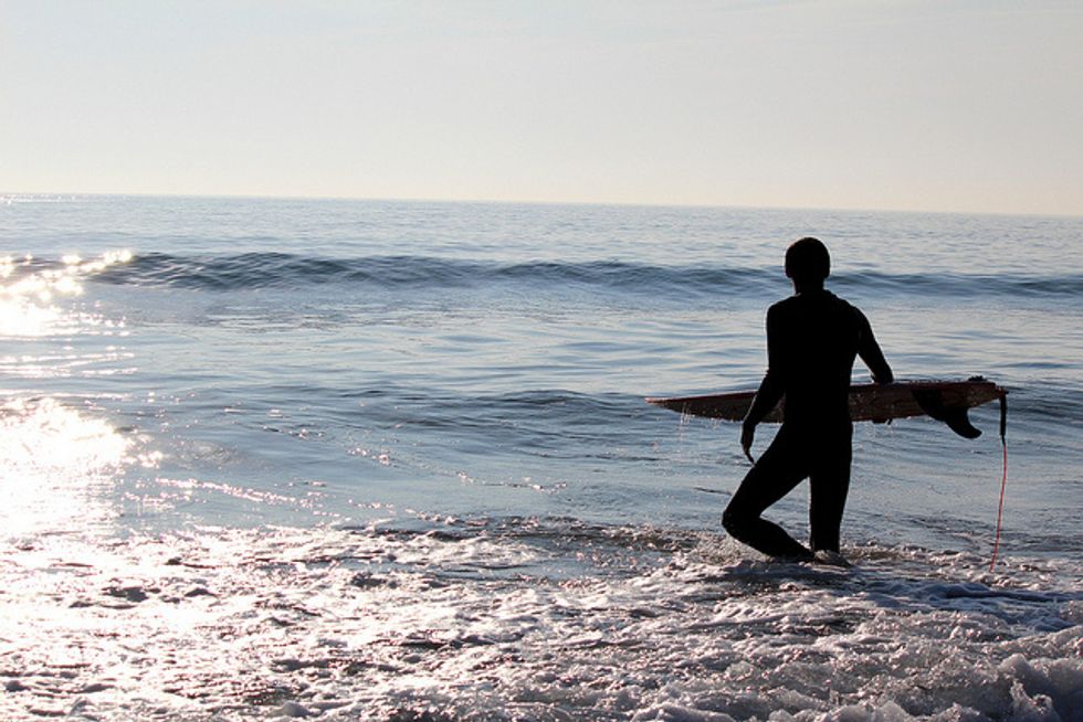
SANTA CRUZ, California — On a summer day in 1885, three Hawaiian princes surfed at the mouth of the San Lorenzo River on crudely constructed boards made from coastal redwoods, bringing the sport to the North American mainland.

Today their wave-riding successors consult satellite weather forecasts on smartphones before heading to Steamer Lane and Pleasure Point in Santa Cruz to don neoprene wetsuits. But the new century could bring the biggest transformation yet to surfing — the waves themselves.

A rapidly changing global climate will likely affect prime surfing spots worldwide. In California, the forecasts for Monterey Bay’s famed big swells, while far from certain, are also far from good.

“It definitely worries me,” said big-wave rider Jake Wormhoudt, who has already noticed changes in water temperature, weather, and sand deposition throughout the 35 years he has surfed in Santa Cruz.

One major source of California’s surfing waves is open-ocean storms that send wave-generating swells toward the California coast. By 2100, these storms could shift, sending their swells on a course parallel to the coast rather than toward it. This change, coupled with dramatic sea-level rise, could eradicate today’s surfing spots.

Scientists came to these conclusions using global climate models — complex, computer-based crystal balls that use past conditions, current trends, and greenhouse gas emission scenarios to predict our climate future.

Researchers recently adjusted these models to account for waves in a warming world, said coastal engineer Li Erikson, of the U.S. Geological Survey in Santa Cruz.

Their findings surprised both scientists and surfers, who assumed a warmer and stormy future might push more waves to the coast. “Well, I thought so, too,” Erikson said with a laugh. But, she explained, storms on land do not necessarily mean higher waves along the coast.

Prime surfing corridors, she and other scientists explain, arise through a perfectly timed combination of deep ocean swells, local winds, and storm fronts — all tossed in just the right direction against offshore shelves to push up the perfect wave. Climate change may simply upset this equilibrium.

“We’ll roll with it,” mused Pete Ogilvie, a Monterey Bay surfer for more than three decades who sums up what many see as the inevitability of change with a laid-back Surf City vibe.

Changes to the surf can come in several forms. With the ocean warming and polar ice caps melting, sea levels are expected to rise along the Northern California coast between one and six feet by the end of the century, which will change when, where, and how waves break on the coast.

“As we increase sea level … those same size waves won’t break over those nice bedrock ridges in the same spots that they used to,” said Curt Storlazzi, a research geologist and oceanographer, also with the USGS office in Santa Cruz. “They’re going to break much closer to shore.”

Some Monterey Bay communities have erected barriers to protect homes and infrastructure from rising seas. In these areas, rising sea levels will eliminate low tide surfing spots, but the barriers would prevent new low tide spots from opening up as well, said David Field, an oceanographer with Hawaii Pacific University who grew up surfing in the Monterey Bay.

John Dee, who has been surfing in and around the bay for 20 years, is concerned about losing the area’s low tide corridors.

“If there’s a three-foot tide, everyone’s out here,” he said recently as he headed out to Steamer Lane. “If there’s a five-foot tide, nobody’s out here.”

These barriers may also contribute to beach erosion, cutting off access to surfing spots.

Even though climate models predict larger storms and waves on the high seas, the North Pacific swell — which generates many of the Monterey Bay’s major winter waves — is expected to shift.

“As the temperature rises, especially in the Arctic, the big winter storms are moving farther north,” Storlazzi said. “So areas along California are going to become less impacted from waves.”

That’s a bummer for local surfers since many of the bay’s best waves come from North Pacific swells.

There’s also a wild card in wave prediction. It’s called El Nino, which is nearly impossible to forecast over the long term.

El Nino conditions bring warm and high waters to the Pacific coast, rolling out a red carpet for strong storms, waves, and winds to slam California directly from the southwest. That could improve surf conditions to the Monterey Bay, at least temporarily.

“They hammer the shoreline,” Storlazzi said. “But they’re the biggest and best waves.”

If the predictions come true and the Monterey Bay closes the 21st century with poor surfing waves, scientists say the shifting climate and rising seas could create better surfing conditions along other seawall-free stretches of the California coastline — but there are too many variables to pinpoint where.

This mixed and uncertain future may leave some surfers and their supporters grasping for certainty. But others are taking a sage-like perspective.

Surfing “is a very experiential or ‘now’ activity,” Ogilvi saide. “When waves die in one spot and pick up in another, you move to that spot.”

Photo: Kieran via Flickr

Slightly Weaker Hurricane Irene Assaults East Coast

MOREHEAD CITY, N.C. (AP) — Hurricane Irene opened its assault on the Eastern Seaboard on Saturday by lashing the North Carolina coast with wind as strong as 115 mph and pounding shoreline homes with waves. Farther north, authorities readied a massive shutdown of trains and airports, with 2 million people ordered out of the way.

The center of the storm passed over North Carolina’s Outer Banks for its official landfall just after 7:30 a.m. EDT. The hurricane’s vast reach traced the East Coast from Myrtle Beach, S.C., to just below Cape Cod. Tropical storm conditions battered Virginia, Maryland and Delaware, with the worst to come.

Irene weakened slightly, with sustained winds down to 85 mph from about 100 a day earlier, making it a Category 1, the least threatening on the scale. The National Hurricane Center reported gusts of 115 mph and storm-surge waves as high as 7 feet.

The first death from the storm was reported in Nash County, N.C., outside Raleigh, where emergency officials said a man was crushed by a large limb that blew off a tree.

Hurricane-force winds arrived near Jacksonville, N.C., at first light, and wind-whipped rain lashed the resort town of Nags Head. Tall waves covered the beach, and the surf pushed as high as the backs of some of the houses and hotels fronting the strand.

“There’s nothing you can do now but wait. You can hear the wind and it’s scary,” said Leon Reasor, who rode out the storm in the Outer Banks town of Buxton. “Things are banging against the house. I hope it doesn’t get worse, but I know it will. I just hate hurricanes.”

At least two piers on the Outer Banks were wiped out, the roof of a car dealership was ripped away, and a hospital in Morehead City that was running on generators. In all, more than 400,000 people were without power on the East Coast.

Susan Kinchen, who showed up at a shelter at a North Carolina high school with her daughter and 5-month-old granddaughter, said she felt unsafe in their trailer. Kinchen, from Louisiana, said she was reminded of how Hurricane Katrina peeled the roof of her trailer there almost exactly six years ago, on Aug. 29, 2005.

“I’m not taking any chances,” she said.

In the Northeast, unaccustomed to tropical weather of any strength, authorities made plans to bring the basic structures of travel grinding to a halt. The New York City subway, the largest in the United States, was making its last runs at noon, and all five area airports were accepting only a few final hours’ worth of flights.

The New York transit system carries 5 million people on weekdays, fewer on weekends, and has never been shut for weather. Transit systems in New Jersey and Philadelphia also announced plans to shut down. Washington declared a state of emergency, days after it had evacuated for an earthquake.

New York City ordered 300,000 people to leave low-lying areas, including the Battery Park City neighborhood at the southern tip of Manhattan, the beachfront Rockaways in Queens and Coney Island in Brooklyn. But it was not clear how many people would get out, or how they would do it.

“How can I get out of Coney Island?” said Abe Feinstein, 82, who has lived for half a century on the eighth floor of a building overlooking the boardwalk. “What am I going to do? Run with this walker?”

Authorities in New York said they would not arrest people who chose to stay, but Mayor Michael Bloomberg warned on Friday: “If you don’t follow this, people may die.”

Streets and subway cars were much emptier than on a typical Saturday morning. On Wall Street, sandbags were placed around subway grates nearest the East River, which is expected to surge as the worst hits New York.

The city’s largest power company said it could cut power to some neighborhoods if the storm causes serious flooding. Salt water can damage power lines, and cutting power would speed repairs.

In all, evacuation orders covered about 2.3 million people, including 1 million in New Jersey, 315,000 in Maryland, 300,000 in North Carolina, 200,000 in Virginia and 100,000 in Delaware. Authorities and experts said it was probably the most people ever threatened by a single storm in the United States.

Airlines said 8,300 flights were canceled, including 3,000 on Saturday. Greyhound suspended bus service between Richmond, Va., and Boston. Amtrak canceled trains in the Northeast for Sunday.

Forecasters said the core of Irene would roll up the mid-Atlantic coast Saturday night and over southern New England on Sunday. Late Saturday morning, Irene was centered about 120 miles south of Norfolk, Va. It was moving north-northeast at 15 mph. Maximum sustained winds remained around 85 mph.

North of the Outer Banks, the storm pounded the Hampton Roads region of southeast Virginia, a jagged network of inlets and rivers that floods easily. Emergency officials there were less worried about the wind and more about storm surge, the high waves that accompany a hurricane. Gas stations there were low on fuel, and grocery stores scrambled to keep water and bread on the shelves.

In Delaware, Gov. Jack Markell ordered an evacuation of coastal areas on the peninsula that the state shares with Maryland and Virginia. In Atlantic City, N.J., all 11 casinos announced they would shut down for only the third time since gambling became legal there 33 years ago.

In Baltimore’s Fells Point, one of the city’s oldest waterfront neighborhoods, people filled sandbags and placed them at building entrances. A few miles away at the Port of Baltimore, vehicles and cranes continued to unload huge cargo ships that were rushing to offload and get away from the storm.

A steady rain fell on the boardwalk at Ocean City, Md., where a small amusement park was shut down and darkened — including a ride called the Hurricane. Businesses were boarded up, many painted with messages like “Irene don’t be mean!”

Charlie Koetzle, 55, who has lived in Ocean City for a decade, came to the boardwalk in swim trunks and flip-flops to look at the sea. While his neighbors and most everyone else had evacuated, Koetzle said he told authorities he wasn’t leaving. To ride out the storm, he had stocked up with soda, roast beef, peanut butter, tuna, nine packs of cigarettes and a detective novel.

Of the storm, he said: “I always wanted to see one.”

Jennifer Peltz reported from New York. Associated Press writers contributing to this report were Tim Reynolds and Christine Armario in Miami; Bruce Shipkowski in Surf City, N.J.; Geoff Mulvihill in Trenton, N.J.; Wayne Parry in Atlantic City, N.J.; Eric Tucker in Washington; Martha Waggoner in Raleigh, N.C.; Mitch Weiss in Nags Head, N.C.; Alex Dominguez in Baltimore; Brock Vergakis in Virginia Beach, Va.; Jonathan Fahey in New York; and Seth Borenstein in Washington.