Low Snowpack Affects California Reservoirs

Low Snowpack Affects California Reservoirs

By Diana Marcum, Los Angeles Times

LAKESHORE, Calif. — The water dropped another 2 feet the week of Don Winters’ vacation.

Huntington Lake was at about a third of its normal level.

An island in the middle of the lake — a mini-hilltop of wildflowers that in other summers he’d paddled to in a canoe — was connected to shore by a bridge of land. It was a quick stroll from the new shoreline, now in the middle of where there used to be water.

But Winters, 65, never considered canceling his High Sierra vacation because of three years of California drought.

“This is the Golden Pond of my youth,” said the retired history teacher. “I used to come here with my grandfather.”

He would come hell or high water, he said, “or I guess you better make that ‘hell or no water.'”

The Sierra snowpack — which provides most of California’s drinking water — was at 32 percent of its average annual depth this winter. Now the state’s largest reservoirs are less than half-full.

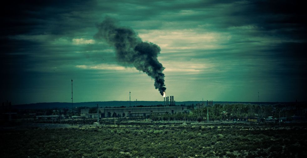
The consequences of the drought are increasing: Many Central Valley farmers have no irrigation water. Migrant farmworker towns are packing up, emptying local schools. California’s delta waters are growing brackish because there has been little runoff from the mountains. The Central Valley is sinking as farmers pump more groundwater.

But none of the drought’s effects may hit home on as visceral a level as summer fun drying up.

The High Sierra Regatta — which had been scheduled to begin last weekend at Huntington Lake — was canceled for the first time in 60 years.

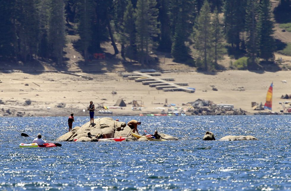
Usually, on two July weekends, this slow-paced mountain community becomes a jam-packed frenzy. Boats dart in and out of slips. Every lakeside rock becomes a seat, and the beach chairs are lined up as closely as on the Cannes seashore.

When there has been normal snowfall, the water almost spills out of the lake by July. The predictable, steady winds that make Huntington a premier sailing lake whip up whitecaps.

It is far quieter this year.

Just the fact that she had time to stop and chat was worth noting, said Elaine Newton, who owns Rancheria Marina with her sister and their husbands. She should be stocking ice and sodas and answering a dozen questions about the marina.

But their docks and moorings were piled up on the dirt — the same as at the other three resorts. Business was about half of what it would usually be this time of year.

The biggest difference to 18-year-old Ashleigh Newton, Elaine’s daughter who runs the marina’s store, was the view.

“I miss not being able to walk outside and have the lake right there,” she said. “It seems so far away.”

It was a flat, blue dot in the distance — no water splashing against docks, only one tiny fishing boat on the entire lake.

Huntington is actually part of a system of three lakes, six dams, and 43 miles of tunnels driven through granite. It drops water from the Sierra backcountry down 6,000 feet, where it is converted into electricity for Southern California.

The lake was created in 1912 and 1913 to fuel fast-growing Los Angeles, 300 miles to the south.

Come summer, that engineering feat is not what’s on the mind of visitors.

The water is deep blue, surrounded by firs and pine. There are no swank hotels — just cabins and old wooden docks. The air is cool, a welcome respite from the broiling Central Valley 70 miles to the west.

In April, when the Fresno Yacht Club sent out its “Attention West Coast Sailors” regatta cancellation notice, it included a picture showing the lake and a red dotted line marking the start and finish of the race — now on dry land.

It’s among a list of activities in the state canceled due to low water, including white water rafting trips and a Father Day’s fishing tournament at Castaic Lake.

Photo: Los Angeles Times/MCT/Mark Boster

Interested in national news? Sign up for our daily email newsletter!

Fresno ranks No. 1 on California pollution list

Fresno ranks No. 1 on California pollution list

By Diana Marcum, Los Angeles Times

FRESNO, Calif. — California’s new effort to map the areas most at risk from pollution features hot spots up and down California.

But nowhere are there more of the worst-afflicted areas than in Fresno — in particular a 3,000-person tract of the city’s west side where diesel exhaust, tainted water, pesticides and poverty conspire to make it No. 1 on California’s toxic hit list.

“I’m looking at this map, and all I see is red. We’re right here,” Daisy Perez, a social worker at the Cecil C. Hinton Community Center, said as she located the center of the red areas that represented the top 10 percent most-polluted census tracts in California. “It’s so sad. Good people live here.”

Pollution has long plagued the Central Valley, where agriculture, topography and poverty have thwarted efforts to clean the air and water. The maps released this week by the California Environmental Protection Agency show that eight of the state’s 10 census tracts most heavily burdened by pollution are in Fresno.

For residents of the state’s worst-scoring area, statistics tell only part of the story of what it is like to live there.

It’s a place where agriculture meets industry, crisscrossed by freeways. The city placed its dumps and meat-rendering plants there decades ago.

Historically, it was the heart of the city’s African-American community. The Central Valley’s civil rights movement was centered in its churches. People referred to it as West Fresno, which meant a culture as well as a place.

These days, young community workers call it by its ZIP Code — the “93706 Zone.”

It’s home to a Latino community — the children and grandchildren of migrant workers; to Hmong and Cambodian farmers; and to a minority African-American community that includes those desperate to leave, and an old guard of those who say they will never abandon home.

“The voice of the community is still black. Because we’re the ones who now have the wherewithal and time to speak,” said Jim Aldredge, who took over running the community center when the city cut its budget. “Look, when you’re just trying to survive, you don’t have time to go before City Council and all that. Pollution data is the farthest thing from your mind when you’re looking for your next meal.”

Aldredge grew up in West Fresno and worked in city government for 20 years, once as city manager. He can point out better than most the stories literally buried beneath the landscape.

There’s the grassy hill — just a mound, really — that constitutes Hyde Park, which was once a dump. Not a landfill, but an old-time dump where people took trash and tires to be burned.

The city is careful to keep the grass green on top of the mound, and a study done before building started on the new junior high school found the land no longer contaminated by chemicals that had seeped into the ground.

Across the street is an animal rendering plant, a chicken plant and an electric substation.

In front of the plants are fields of strawberries, giving way to orchards of pistachio and fruit trees.

This area ranks in the 90th percentile for pesticide applications, according to the state.

“But we don’t talk about the pesticides,” Aldredge said. “The agricultural folks are so strong.”

On Tuesday, a bright blue day, a breeze kicked up dust devils in a wide open field of dirt across the street from a housing tract.

This was where Donald Trump once planned to build a golf course designed by Jack Nicholson, surrounded by country club homes. Now it is dust. Fine particulate matter is one of the leading causes of air pollution in Fresno during the winter months.

The most controversial industry in the area is the Darling International meat processing plant.

A vocal group of residents led by Mary Curry, who lives downwind from the stench, maintains a strong public outcry.

According to the Cal/EPA data, the nearby Cargill rendering plant actually releases more pollutants into the air than the Darling plant.

But there is no organized push against that plant, which sits near the intersection of two freeways in the census tract, known as Edison, with the most health risks in all of California.

The new data — the first of its kind in the country — looks at a community’s level of education and ability to communicate with the power structure as well as environmental factors.

When Aldredge was a teenager — a standout baseball player intent on leaving West Fresno behind — he would walk by tallow plants with dead horses and cows outside and a slaughterhouse that always smelled.

“I don’t know that I even knew different,” he said. “It was just the way things were.”

On Tuesdays, when the community center gives out food, part of Daisy Perez’s work is to ask residents what they like about their neighborhood and what bothers them.

“They always say that they like that it’s quiet. People like the country feel and the community feel,” she said. “But they always complain about headaches, especially when the wind blows. They think it’s the smell from the meat plants or maybe the pesticides.”

A breeze carried a smell from a meat rendering plant. Perez said she found it a choking stench and had to fight a gag reflex.

Shakur Tyson, 14, who goes to school and works at the center, said at first he didn’t smell anything.

Then he said he was starting to notice a bit of a smell.

“I’m just used to it. I guess,” he said. “It’s the way things are.”

Flickr via Agustín Ruiz