Tag: arctic
Amid Climate Change, Dangerous War Games In The Arctic

Amid Climate Change, Dangerous War Games In The Arctic

Reprinted with permission from TomDispatch.

In early March, an estimated 7,500 American combat troops will travel to Norway to join thousands of soldiers from other NATO countries in a massive mock battle with imagined invading forces from Russia. In this futuristic simulated engagement — it goes by the name of Exercise Cold Response 2020 — allied forces will “conduct multinational joint exercises with a high-intensity combat scenario in demanding winter conditions,” or so claims the Norwegian military anyway. At first glance, this may look like any other NATO training exercise, but think again. There’s nothing ordinary about Cold Response 2020. As a start, it’s being staged above the Arctic Circle, far from any previous traditional NATO battlefield, and it raises to a new level the possibility of a great-power conflict that might end in a nuclear exchange and mutual annihilation. Welcome, in other words, to World War III’s newest battlefield.

For the soldiers participating in the exercise, the potentially thermonuclear dimensions of Cold Response 2020 may not be obvious. At its start, Marines from the United States and the United Kingdom will practice massive amphibious landings along Norway’s coastline, much as they do in similar exercises elsewhere in the world. Once ashore, however, the scenario becomes ever more distinctive. After collecting tanks and other heavy weaponry “prepositioned” in caves in Norway’s interior, the Marines will proceed toward the country’s far-northern Finnmark region to help Norwegian forces stave off Russian forces supposedly pouring across the border. From then on, the two sides will engage in — to use current Pentagon terminology — high-intensity combat operations under Arctic conditions (a type of warfare not seen on such a scale since World War II).

And that’s just the beginning. Unbeknownst to most Americans, the Finnmark region of Norway and adjacent Russian territory have become one of the most likely battlegrounds for the first use of nuclear weapons in any future NATO-Russian conflict. Because Moscow has concentrated a significant part of its nuclear retaliatory capability on the Kola Peninsula, a remote stretch of land abutting northern Norway — any U.S.-NATO success in actualcombat with Russian forces near that territory would endanger a significant part of Russia’s nuclear arsenal and so might precipitate the early use of such munitions. Even a simulated victory — the predictable result of Cold Response 2020 — will undoubtedly set Russia’s nuclear controllers on edge.

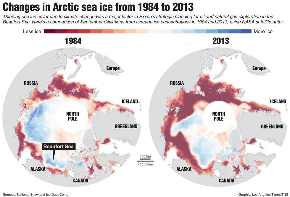
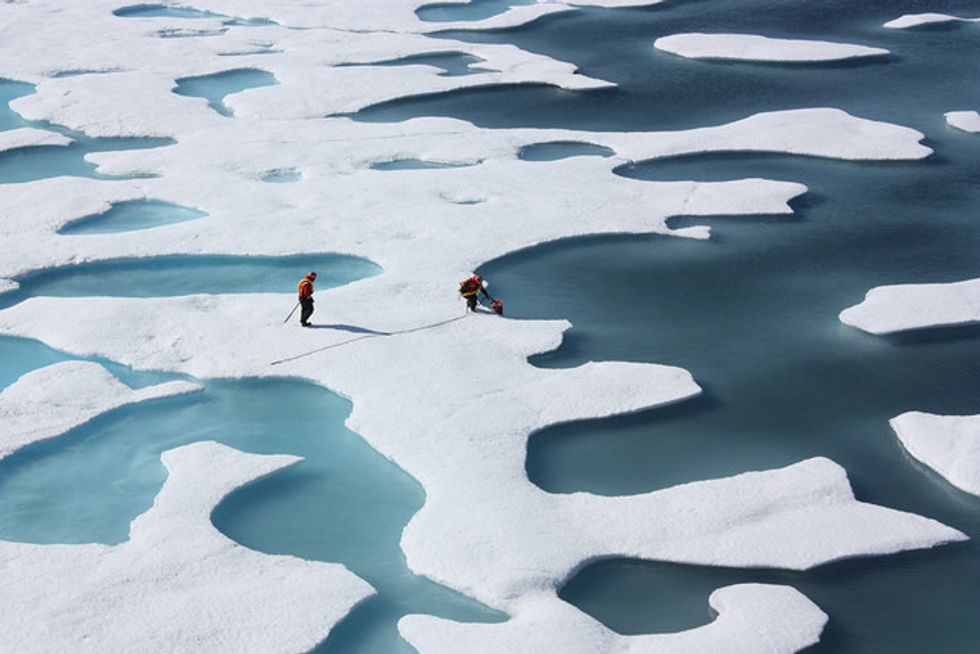
To appreciate just how risky any NATO-Russian clash in Norway’s far north would be, consider the region’s geography and the strategic factors that have led Russia to concentrate so much military power there. And all of this, by the way, will be playing out in the context of another existential danger: climate change. The melting of the Arctic ice cap and the accelerated exploitation of Arctic resources are lending this area ever greater strategic significance.

Energy Extraction in the Far North

Look at any map of Europe and you’ll note that Scandinavia widens as it heads southward into the most heavily populated parts of Denmark, Finland, Norway, and Sweden. As you head north, however, it narrows and becomes ever less populated. At its extreme northern reaches, only a thin band of Norway juts east to touch Russia’s Kola Peninsula. To the north, the Barents Sea, an offshoot of the Arctic Ocean, bounds them both. This remote region — approximately 800 miles from Oslo and 900 miles from Moscow — has, in recent years, become a vortex of economic and military activity.

Once prized as a source of vital minerals, especially nickel, iron ore, and phosphates, this remote area is now the center of extensive oil and natural gas extraction. With temperatures rising in the Arctic twice as fast as anywhere else on the planet and sea ice retreating ever farther north every year, offshore fossil-fuel exploration has become increasingly viable. As a result, large reserves of oil and natural gas — the very fuels whose combustion is responsible for those rising temperatures — have been discovered beneath the Barents Sea and both countries are seeking to exploit those deposits. Norway has taken the lead, establishing at Hammerfest in Finnmark the world’s first plant above the Arctic Circle to export liquified natural gas. In a similar fashion, Russia has initiated efforts to exploit the mammoth Shtokman gas field in its sector of the Barents Sea, though it has yet to bring such plans to fruition.

For Russia, even more significant oil and gas prospects lie further east in the Kara and Pechora Seas and on the Yamal Peninsula, a slender extension of Siberia. Its energy companies have, in fact, already begun producing oil at the Prirazlomnoye field in the Pechora Sea and the Novoportovskoye field on that peninsula (and natural gas there as well). Such fields hold great promise for Russia, which exhibits all the characteristics of a petro-state, but there’s one huge problem: the only practical way to get that output to market is via specially-designed icebreaker-tankers sent through the Barents Sea past northern Norway.

The exploitation of Arctic oil and gas resources and their transport to markets in Europe and Asia has become a major economic priority for Moscow as its hydrocarbon reserves below the Arctic Circle begin to dry up. Despite calls at home for greater economic diversity, President Vladimir Putin’s regime continues to insist on the centrality of hydrocarbon production to the country’s economic future. In that context, production in the Arctic has become an essential national objective, which, in turn, requires assured access to the Atlantic Ocean via the Barents Sea and Norway’s offshore waters. Think of that waterway as vital to Russia’s energy economy in the way the Strait of Hormuz, connecting the Persian Gulf to the Indian Ocean, is to the Saudis and other regional fossil-fuel producers.

The Military Dimension

No less than Russia’s giant energy firms, its navy must be able to enter the Atlantic via the Barents Sea and northern Norway. Aside from its Baltic and Black Sea ports, accessible to the Atlantic only via passageways easily obstructed by NATO, the sole Russian harbor with unfettered access to the Atlantic Ocean is at Murmansk on the Kola Peninsula. Not surprisingly then, that port is also the headquarters for Russia’s Northern Fleet — its most powerful — and the site of numerous air, infantry, missile, and radar bases along with naval shipyards and nuclear reactors. In other words, it’s among the most sensitive military regions in Russia today.

Given all this, President Putin has substantially rebuilt that very fleet, which fell into disrepair after the collapse of the Soviet Union, equipping it with some of the country’s most advanced warships. In 2018, according to The Military Balance, a publication of the International Institute for Strategic Studies, it already possessed the largest number of modern cruisers and destroyers (10) of any Russian fleet, along with 22 attack submarines and numerous support vessels. Also in the Murmansk area are dozens of advanced MiG fighter planes and a wide assortment of anti-aircraft defense systems. Finally, as 2019 ended, Russian military officials indicated for the first time that they had deployed to the Arctic the Kinzhal air-launched ballistic missile, a weapon capable of hypersonic velocities (more than five times the speed of sound), again presumably to a base in the Murmansk region just 125 miles from Norway’s Finnmark, the site of the upcoming NATO exercise.

More significant yet is the way Moscow has been strengthening its nuclear forces in the region. Like the United States, Russia maintains a “triad” of nuclear delivery systems, including intercontinental ballistic missiles (ICBMs), long-range “heavy” bombers, and submarine-launched ballistic missiles (SLBMs). Under the terms of the New Strategic Arms Reduction Treaty (New START), signed by the two countries in 2010, the Russians can deploy no more than 700 delivery systems capable of carrying no more than 1,550 warheads. (That pact will, however, expire in February 2021 unless the two sides agree to an extension, which appears increasingly unlikely in the age of Trump.) According to the Arms Control Association, the Russians are currently believed to be deploying the warheads they are allowed under New START on 66 heavy bombers, 286 ICBMs, and 12 submarines with 160 SLBMs. Eight of those nuclear-armed subs are, in fact, assigned to the Northern Fleet, which means about 110 missiles with as many as 500 warheads — the exact numbers remain shrouded in secrecy — are deployed in the Murmansk area.

For Russian nuclear strategists, such nuclear-armed submarines are considered the most “survivable” of the country’s retaliatory systems. In the event of a nuclear exchange with the United States, the country’s heavy bombers and ICBMs could prove relatively vulnerable to pre-emptive strikes as their locations are known and can be targeted by American bombs and missiles with near-pinpoint accuracy. Those subs, however, can leave Murmansk and disappear into the wide Atlantic Ocean at the onset of any crisis and so presumably remain hidden from U.S. spying eyes. To do so, however, requires that they pass through the Barents Sea, avoiding the NATO forces lurking nearby. For Moscow, in other words, the very possibility of deterring a U.S. nuclear strike hinges on its ability to defend its naval stronghold in Murmansk, while maneuvering its submarines past Norway’s Finnmark region. No wonder, then, that this area has assumed enormous strategic importance for Russian military planners — and the upcoming Cold Response 2020 is sure to prove challenging to them.

Washington’s Arctic Buildup

During the Cold War era, Washington viewed the Arctic as a significant strategic arena and constructed a string of military bases across the region. Their main aim: to intercept Soviet bombers and missiles crossing the North Pole on their way to targets in North America. After the Soviet Union imploded in 1991, Washington abandoned many of those bases. Now, however, with the Pentagon once again identifying “great power competition” with Russia and China as the defining characteristic of the present strategic environment, many of those bases are being reoccupied and new ones established. Once again, the Arctic is being viewed as a potential site of conflict with Russia and, as a result, U.S. forces are being readied for possible combat there.

Secretary of State Mike Pompeo was the first official to explain this new strategic outlook at the Arctic Forum in Finland last May. In his address, a kind of “Pompeo Doctrine,” he indicated that the United States was shifting from benign neglect of the region to aggressive involvement and militarization. “We’re entering a new age of strategic engagement in the Arctic,” he insisted, “complete with new threats to the Arctic and its real estate, and to all of our interests in that region.” To better protect those interests against Russia’s military buildup there, “we are fortifying America’s security and diplomatic presence in the area… hosting military exercises, strengthening our force presence, rebuilding our icebreaker fleet, expanding Coast Guard funding, and creating a new senior military post for Arctic Affairs inside of our own military.”

The Pentagon has been unwilling to provide many details, but a close reading of the military press suggests that this activity has been particularly focused on northern Norway and adjacent waters. To begin with, the Marine Corps has established a permanent presence in that country, the first time foreign forces have been stationed there since German troops occupied it during World War II. A detachment of about 330 Marines were initially deployed near the port of Trondheim in 2017, presumably to help guard nearby caves that contain hundreds of U.S. tanks and combat vehicles. Two years later, a similarly sized group was then dispatched to the Troms region above the Arctic Circle and far closer to the Russian border.

From the Russian perspective, even more threatening is the construction of a U.S. radar station on the Norwegian island of Vardø about 40 miles from the Kola Peninsula. To be operated in conjunction with the Norwegian intelligence service, the focus of the facility will evidently be to snoop on those Russian missile-carrying submarines, assumedly in order to target them and take them out in the earliest stages of any conflict. That Moscow fears just such an outcome is evident from the mock attack it staged on the Vardø facility in 2018, sending 11 Su-24 supersonic bombers on a direct path toward the island. (They turned aside at the last moment.) It has also moved a surface-to-surface missile battery to a spot just 40 miles from Vardø.

In addition, in August 2018, the U.S. Navy decided to reactivate the previously decommissioned Second Fleet in the North Atlantic. “A new Second Fleet increases our strategic flexibility to respond — from the Eastern Seaboard to the Barents Sea,” said Chief of Naval Operations John Richardson at the time. As last year ended, that fleet was declared fully operational.

Deciphering Cold Response 2020

Exercise Cold Response 2020 must be viewed in the context of all these developments. Few details about the thinking behind the upcoming war games have been made public, but it’s not hard to imagine what at least part of the scenario might be like: a U.S.-Russian clash of some sort leading to Russian attacks aimed at seizing that radar station at Vardø and Norway’s defense headquarters at Bodø on the country’s northwestern coast. The invading troops will be slowed but not stopped by Norwegian forces (and those U.S. Marines stationedin the area), while thousands of reinforcements from NATO bases elsewhere in Europe begin to pour in. Eventually, of course, the tide will turn and the Russians will be forced back.

No matter what the official scenario is like, however, for Pentagon planners the situation will go far beyond this. Any Russian assault on critical Norwegian military facilities would presumably be preceded by intense air and missile bombardment and the forward deployment of major naval vessels. This, in turn, would prompt comparable moves by the U.S. and NATO, probably resulting in violent encounters and the loss of major assets on all sides. In the process, Russia’s key nuclear retaliatory forces would be at risk and quickly placed on high alert with senior officers operating in hair-trigger mode. Any misstep might then lead to what humanity has feared since August 1945: a nuclear apocalypse on Planet Earth.

There is no way to know to what degree such considerations are incorporated into the classified versions of the Cold Response 2020 scenario, but it’s unlikely that they’re missing. Indeed, a 2016 version of the exercise involved the participation of three B-52 nuclear bombers from the U.S. Strategic Air Command, indicating that the American military is keenly aware of the escalatory risks of any large-scale U.S.-Russian encounter in the Arctic.

In short, what might otherwise seem like a routine training exercise in a distant part of the world is actually part of an emerging U.S. strategy to overpower Russia in a critical defensive zone, an approach that could easily result in nuclear war. The Russians are, of course, well aware of this and so will undoubtedly be watching Cold Response 2020 with genuine trepidation. Their fears are understandable — but we should all be concerned about a strategy that seemingly embodies such a high risk of future escalation.

Ever since the Soviets acquired nuclear weapons of their own in 1949, strategists have wondered how and where an all-out nuclear war — World War III — would break out. At one time, that incendiary scenario was believed most likely to involve a clash over the divided city of Berlin or along the East-West border in Germany. After the Cold War, however, fears of such a deadly encounter evaporated and few gave much thought to such possibilities. Looking forward today, however, the prospect of a catastrophic World War III is again becoming all too imaginable and this time, it appears, an incident in the Arctic could prove the spark for Armageddon.

Michael T. Klare, a TomDispatch regular, is the five-college professor emeritus of peace and world security studies at Hampshire College and a senior visiting fellow at the Arms Control Association. He is the author of 15 books, including the just-published All Hell Breaking Loose: The Pentagon’s Perspective on Climate Change (Metropolitan Books), on which this article is based.

Follow TomDispatch on Twitter and join us on Facebook. Check out the newest Dispatch Books, John Feffer’s new dystopian novel (the second in the Splinterlands series) Frostlands, Beverly Gologorsky’s novel Every Body Has a Story, and Tom Engelhardt’s A Nation Unmade by War, as well as Alfred McCoy’s In the Shadows of the American Century: The Rise and Decline of U.S. Global Power and John Dower’s The Violent American Century: War and Terror Since World War II.

Copyright 2020 Michael T. Klare

What Exxon Knew About Global Warming’s Impact On The Arctic

What Exxon Knew About Global Warming’s Impact On The Arctic

By Sara Jerving, Katie Jennings, Masako Melissa Hirsch and Susanne Rust, Energy and Environmental Reporting Project (TNS)

Back in 1990, as the debate over climate change was heating up, a dissident shareholder petitioned the board of Exxon, one of the world’s largest oil companies, imploring it to develop a plan to reduce carbon dioxide emissions from its production plants and facilities.

The board’s response: Exxon had studied the science of global warming and concluded it was too murky to warrant action. The company’s “examination of the issue supports the conclusions that the facts today and the projection of future effects are very unclear.”

Yet in the far northern regions of Canada’s Arctic frontier, researchers and engineers at Exxon and Imperial Oil were quietly incorporating climate change projections into the company’s planning and closely studying how to adapt the company’s Arctic operations to a warming planet.

Ken Croasdale, senior ice researcher for Exxon’s Canadian subsidiary, was leading a Calgary-based team of researchers and engineers that was trying to determine how global warming could affect Exxon’s Arctic operations and its bottom line.

“Certainly any major development with a life span of, say, 30-40 years will need to assess the impacts of potential global warming,” Croasdale told an engineering conference in 1991. “This is particularly true of Arctic and offshore projects in Canada, where warming will clearly affect sea ice, icebergs, permafrost and sea levels.”

Between 1986 and 1992, Croasdale’s team looked at both the positive and negative effects that a warming Arctic would have on oil operations, reporting its findings to Exxon headquarters in Houston and New Jersey.

The good news for Exxon, he told an audience of academics and government researchers in 1992, was that “potential global warming can only help lower exploration and development costs” in the Beaufort Sea.

But, he added, it also posed hazards, including higher sea levels and bigger waves, which could damage the company’s existing and future coastal and offshore infrastructure, including drilling platforms, artificial islands, processing plants and pump stations. And a thawing earth could be troublesome for those facilities as well as pipelines.

As Croasdale’s team was closely studying the impact of climate change on the company’s operations, Exxon and its worldwide affiliates were crafting a public policy position that sought to downplay the certainty of global warming.

The gulf between Exxon’s internal and external approach to climate change from the 1980s through the early 2000s was evident in a review of hundreds of internal documents, decades of peer-reviewed published material and dozens of interviews conducted by Columbia University’s Energy & Environmental Reporting Project and the Los Angeles Times.

Documents were obtained from the Imperial Oil collection at Calgary’s Glenbow Museum and the ExxonMobil Historical Collection at the University of Texas at Austin’s Briscoe Center for American History.

“We considered climate change in a number of operational and planning issues,” said Brian Flannery, who was Exxon’s in-house climate science adviser from 1980 to 2011. In a recent interview, he described the company’s internal effort to study the effects of global warming as a competitive necessity: “If you don’t do it, and your competitors do, you’re at a loss.”
___
The Arctic holds about one-third of the world’s untapped natural gas and roughly 13 percent of the planet’s undiscovered oil, according to the U.S. Geological Survey. More than three-quarters of Arctic deposits are offshore.

Imperial Oil, about 70 percent of which is owned by Exxon Mobil, began drilling in the frigid Arctic waters of the Canadian Beaufort Sea in the early 1970s. By the early 1990s, it had drilled two dozen exploratory wells.

The exploration was expensive, due to bitter temperatures, wicked winds and thick sea ice. And when a worldwide oil slump drove petroleum prices down in the late 1980s, the company began scaling back those efforts.

But with mounting evidence the planet was warming, company scientists, including Croasdale, wondered whether climate change might alter the economic equation. Could it make Arctic oil exploration and production easier and cheaper?

“The issue of CO2 emissions was certainly well-known at that time in the late 1980s,” Croasdale said in an interview.

Since the late 1970s and into the 1980s, Exxon had been at the forefront of climate change research, funding its own internal science as well as research from outside experts at Columbia University and MIT.

With company support, Croasdale spearheaded the company’s efforts to understand climate change’s effects on its operations. A company such as Exxon, he said, “should be a little bit ahead of the game trying to figure out what it was all about.”

Exxon Mobil describes its efforts in those years as standard operating procedure. “Our researchers considered a wide range of potential scenarios, of which potential climate change impacts such as rising sea levels was just one,” said Alan Jeffers, a spokesman for Exxon Mobil.

The Arctic seemed an obvious region to study, Croasdale and other experts said, because it was likely to be most affected by global warming.

That reasoning was backed by models built by Exxon scientists, including Flannery, as well as Marty Hoffert, a New York University physicist. Their work, published in 1984, showed that global warming would be most pronounced near the poles.

Between 1986, when Croasdale took the reins of Imperial’s frontier research team, until 1992, when he left the company, his team of engineers and scientists used the global circulation models developed by the Canadian Climate Centre and NASA’s Goddard Institute for Space Studies to anticipate how climate change could affect a variety of operations in the Arctic.

These were the same models that — for the next two decades — Exxon’s executives publicly dismissed as unreliable and based on uncertain science. As Chief Executive Lee Raymond explained at an annual meeting in 1999, future climate “projections are based on completely unproven climate models, or, more often, on sheer speculation.”

One of the first areas the company looked at was how the Beaufort Sea could respond to a doubling of carbon dioxide in the atmosphere, which the models predicted would happen by 2050.

Greenhouse gases are rising “due to the burning of fossil fuels,” Croasdale told an audience of engineers at a conference in 1991. “Nobody disputes this fact,” he said, nor did anyone doubt those levels would double by the middle of the 21st century.

Using the models and data from a climate change report issued by Environment Canada, Canada’s environmental agency, the team concluded that the Beaufort Sea’s open water season — when drilling and exploration occurred — would lengthen from two months to three and possibly five months.

They were spot on.

In the years following Croasdale’s conclusions, the Beaufort Sea has experienced some of the largest losses in sea ice in the Arctic and its open water season has increased significantly, according to Mark Serreze, a senior researcher at the National Snow and Ice Data Center in Boulder, Colo.

For instance, in Alaska’s Chukchi Sea, west of the Beaufort, the season has been extended by 79 days since 1979, Serreze said.

An extended open water season, Croasdale said in 1992, could potentially reduce exploratory drilling and construction costs by 30 percent to 50 percent.

He did not recommend making investment decisions based on those scenarios, because he believed the science was still uncertain. However, he advised the company to consider and incorporate potential “negative outcomes,” including a rise in the sea level, which could threaten onshore infrastructure; bigger waves, which could damage offshore drilling structures; and thawing permafrost, which could make the earth buckle and slide under buildings and pipelines.
___
The most pressing concerns for the company centered on a 540-mile pipeline that crossed the Northwest Territories into Alberta, its riverside processing facilities in the remote town of Norman Wells, and a proposed natural gas facility and pipeline in the Mackenzie River Delta, on the shores of the Beaufort Sea.

The company hired Stephen Lonergan, a Canadian geographer from McMaster University, to study the effect of climate change there.
Lonergan used several climate models in his analysis, including the NASA model. They all concluded that things would get warmer and wetter and that those effects “cannot be ignored,” he said in his report.

As a result, the company should expect “maintenance and repair costs to roads, pipelines and other engineering structures” to be sizable in the future, he wrote.

A warmer Arctic would threaten the stability of permafrost, he noted, potentially damaging the buildings, processing plants and pipelines that were built on the solid, frozen ground.

In addition, the company should expect more flooding along its riverside facilities, an earlier spring breakup of the ice pack, and more-severe summer storms.

But it was the increased variability and unpredictability of the weather that was going to be the company’s biggest challenge, he said.

Record-breaking droughts, floods and extreme heat — the worst-case scenarios — were now events that not only were likely to happen, but could occur at any time, making planning for such scenarios difficult, Lonergan warned the company in his report. Extreme temperatures and precipitation “should be of greatest concern,” he wrote, “both in terms of future design and … expected impacts.”

The fact that temperatures could rise above freezing on almost any day of the year got his superiors’ attention. That “was probably one of the biggest results of the study and that shocked a lot of people,” he said in a recent interview.

Lonergan recalled that his report came as somewhat of a disappointment to Imperial’s management, which wanted specific advice on what action it should take to protect its operations. After presenting his findings, he remembered, one engineer said: “Look, all I want to know is: Tell me what impact this is going to have on permafrost in Norman Wells and our pipelines.”

As it happened, J.F. “Derick” Nixon, a geotechnical engineer on Croasdale’s team, was studying that question.

He looked at historical temperature data and concluded Norman Wells could grow about 0.2 degrees warmer every year. How would that, he wondered, affect the frozen ground underneath buildings and pipelines?

“Although future structures may incorporate some consideration of climatic warming in their design,” he wrote in a technical paper delivered at a conference in Canada in 1991, “northern structures completed in the recent past do not have any allowance for climatic warming.” The result, he said, could be significant settling.

Nixon said the work was done in his spare time and not commissioned by the company. However, Imperial “was certainly aware of my work and the potential effects on their buildings.”

___
Exxon Mobil declined to respond to requests for comment on what steps it took as a result of its scientists’ warnings. According to Flannery, the company’s in-house climate expert, much of the work of shoring up support for the infrastructure was done as routine maintenance.

“You build it into your ongoing system and it becomes a part of what you do,” he said.

Today, as Exxon’s scientists predicted 25 years ago, Canada’s Northwest Territories has experienced some of the most dramatic effects of global warming. While the rest of the planet has seen an average increase of roughly 1.5 degrees in the last 100 years, the northern reaches of the province have warmed by 5.4 degrees and temperatures in central regions have increased by 3.6 degrees.

Since 2012, Exxon Mobil and Imperial have held the rights to more than 1 million acres in the Beaufort Sea, for which they bid $1.7 billion in a joint venture with BP. Although the companies have not begun drilling, they requested a lease extension until 2028 from the Canadian government a few months ago. Exxon Mobil declined to comment on its plans there.

Croasdale, who still consults for Exxon, said the company could be “taking a gamble” the ice will break up soon, finally bringing about the day he predicted so long ago — when the costs would become low enough to make Arctic exploration economical.
___
ABOUT THIS STORY
Over the last year, the Energy and Environmental Reporting Project at Columbia University’s Graduate School of Journalism, with the Los Angeles Times, has been researching the gap between Exxon Mobil’s public position and its internal planning on the issue of climate change. As part of that effort, reporters reviewed hundreds of documents housed in archives in Calgary’s Glenbow Museum and at the University of Texas. They also reviewed scientific journals and interviewed dozens of experts, including former ExxonMobil employees. This is the first in a series of occasional articles. Amy Lieberman and Elah Feder contributed to this report.

Graphic: Map of Arctic sea ice change from 1984 to 2013. Tribune News Service 2015.

Obama’s Arctic Adventure Ends With Sinking Village, Fish Spawn

Obama’s Arctic Adventure Ends With Sinking Village, Fish Spawn

By Roberta Rampton

KOTZEBUE, Alaska (Reuters) — President Barack Obama got a taste of the U.S. Arctic on Wednesday, dropping in to two remote fly-in native villages in a journey the White House hopes will show how climate change is affecting Americans.

Crossing the Arctic Circle, Air Force One flew over Kivalina, pop. 400, a whaling village on a barrier island debating whether to move as melting sea ice raises sea levels.

Obama said Kivalina is a harbinger of hardships other parts of the country could face if global warming goes unchecked.

“I’ve been trying to make the rest of the country more aware of the changing climate — but you’re already living it,” Obama told a crowd jammed into a school gym.

It was the culmination of a three-day adventure in which Obama hiked to a glacier and toured majestic fjords by boat, delighting residents in a vast and sparsely populated state often left off presidential itineraries.

“It’s the best thing I’ve ever seen before: the president, in Kotzebue, my hometown!” said Betty Kingeak, 26, who is a cashier and delivery driver at Little Louie’s restaurant.

Kingeak said she worries climate change could mean her children will not be able to camp, hunt, and fish like she does.

Obama, the first sitting president to cross the Arctic Circle, is pushing to marshal support for an international agreement to reduce carbon emissions.

He also wants to convince Congress to back at least one new heavy ice breaker for the U.S. Coast Guard, a national security priority underscored by a report on Wednesday that Chinese navy ships were in the Bering Sea near Alaska.

‘Uh-Oh’

Earlier on Wednesday, Obama visited Dillingham, a town on Bristol Bay, home to one of the world’s largest sockeye salmon fisheries, where two women gave him a crash course in catching salmon in traditional nets.

“I’ve got to get some gloves so I can handle my fish,” Obama said, donning an orange pair and hoisting a still-flopping silver salmon.

The fish promptly relieved itself on his shoes.

“Uh-oh. What happened there?” he said, laughing as the women explained the fish was spawning.

He tried his hand at Yup’ik native dancing with grade school students before taking his motorcade down the main drag, passing a fishing boat with the hulking head of a recently killed moose.

At the N + N Market, where a large bag of Doritos cost $9.39, Obama talked about the high costs of food in places where almost everything has to be shipped in.

The community was plastered with signs like “Mines and fish don’t co-exist” protesting against the Pebble Mine copper and gold project proposed by Northern Dynasty Minerals Ltd.

The Environmental Protection Agency has placed restrictions on the proposed mine, which the company is fighting in court.

“Our view is that if the president is interested in the issue he should try to hear from all perspectives about it, including those closest to Pebble who would like the jobs Pebble may provide,” said Mike Heatwole, a spokesman for Pebble Limited Partnership.

Obama did not address the mine directly, but noted he had taken steps this year to shut off Bristol Bay from oil and gas exploration to protect the fishing industry.

“There are other threats to this environment that we’ve always got to be alert to,” Obama said.

(Additional reporting by Steve Quinn in Juneau, Alaska; Editing by Louise Ireland, Toni Reinhold)

Photo: U.S. President Barack Obama (C) observes traditional salmon preserving with fishermen on the shore of the Nushagak River in Dillingham, Alaska, September 2, 2015. REUTERS/Jonathan Ernst

Democrat Hillary Clinton Says Arctic Drilling ‘Not Worth The Risk’

Democrat Hillary Clinton Says Arctic Drilling ‘Not Worth The Risk’

(Reuters) – Democratic presidential candidate Hillary Clinton said in a Twitter post on Tuesday that drilling for oil and gas in the Arctic Ocean was “not worth the risk.”

“The Arctic is a unique treasure,” Clinton said.

The Obama administration on Monday gave Royal Dutch Shell final approval to resume drilling in the environmentally fragile ocean for the first time since 2012.

(Reporting by Emily Stephenson and Amanda Becker; Editing by Lisa Lambert)

Photo: U.S. Democratic presidential candidate Hillary Clinton speaks at the Iowa Democratic Wing Ding dinner in Clear Lake, Iowa, United States, August 14, 2015.  REUTERS/Jim Young