Tag: flood
Fourteen Dead In W. Virginia In State’s Worst Floods In A Century

Fourteen Dead In W. Virginia In State’s Worst Floods In A Century

By Laila Kearney and Barbara Goldberg

(Reuters) – At least 14 people in West Virginia have died and hundreds more have been rescued from swamped homes in the state’s worst flooding in more than a century, government officials said on Friday.

The mountainous state was pummeled by up to 10 inches of rain on Thursday, causing rivers and streams to overflow into neighboring communities.

“The damage is widespread and devastating,” Governor Earl Ray Tomblin said at a news conference. “Our biggest challenge continues to be high waters.”

Multiple rivers have risen to dangerous heights, including the Elk River, which reached 32 feet, the highest since 1888, Tomblin said.

Government officials are focusing resources on rescuing those trapped or swept away by the flooding, he said, adding that some 66,000 residences are without power.

The governor declared a state of emergency in 44 of 55 counties and deployed 200 members of the West Virginia National Guard to help rescue efforts on Friday.

Though rivers were expected to crest by Friday night, the rescue and recovery effort is likely to last through the weekend, said Tim Rock, spokesman for the West Virginia Division of Homeland Security and Emergency Management.

“There have been towns that have been completely surrounded by water,” Rock said. “People say there is 8 to 9 feet of water in their house.

“It’s at least into the hundreds forced to get emergency shelter,” he said. “Even if you can get back into your home, who knows what kind of shape it’s in.”

West Virginia received one-quarter of its annual rainfall in a single day, National Weather Service meteorologist Frank Pereira said.

“It was multiple rounds of thunderstorms that continued to move across the same area, a relatively small area, and the mountainous terrain exacerbated theflooding,” Pereira said.

Rains eased on Friday with only scattered showers expected, he said.

The storms that drenched West Virginia were part of a severe weather system that has swept through the U.S. Midwest, triggering tornadoes.

(Reporting by Barbara Goldberg and Laila Kearney in New York; Editing by Jeffrey Benkoe and Leslie Adler)

Rising Tide Of State Buyouts Fights Flooding

Rising Tide Of State Buyouts Fights Flooding

By Tim Henderson, Stateline.org (TNS)

WASHINGTON — For decades, state and local governments across the country have been buying private homes near flood-prone rivers and tearing them down to save millions on flood insurance.

But as coastal communities are confronted with increasingly costly storms, they, too, are turning to buyouts, to create natural buffers along the coast and help protect nearby neighborhoods and businesses from flooding. And while some efforts have met resistance — some don’t want to leave their beachfront homes, some fear a declining property tax base — others are showing results.

After suffering heavy losses from Hurricane Sandy in 2012, New York pledged to spend $400 million in federal and state money on buyouts to create more buffers on the coasts of Long Island and Staten Island. The state has made 525 offers, worth $64 million, out of 750 to 1,000 it had anticipated in 2013.

New Jersey has a similar goal. After Sandy, the state used the same mix of federal grants and state funds to put $300 million into its existing Blue Acres program, and said it expected to clear 1,300 homes from flood-prone areas near rivers and the coastline.

The Garden State has made 700 offers and closed on more than 400 properties.

Although many coastal homeowners were willing to sell, the state found it was unable to buy enough houses — despite offering pre-storm prices for storm-damaged houses — in clusters that would allow for buffers of open space.

Some property owners simply didn’t want to leave, said Bob Considine, of the state’s environmental agency.

That’s not unusual, said Chad Berginnis, director of the Association of State Floodplain Managers. Beachfront houses serve as valuable rental property that owners don’t want to part with.

The post-Sandy programs in New York and New Jersey, which rely on allotments from the U.S. Department of Housing and Urban Development (HUD), are the largest buyout investments by single states.

But similar programs exist in nearly every state, and are run by other federal agencies with state and local partnerships. A program run by the Federal Emergency Management Agency has spent almost $900 million since 1998 on buyouts in 48 states. State and local governments organize the buyouts, and typically provide 25 percent of the funds, with the rest coming from the federal government. In some cases, the federal share can be higher.

In almost two decades, about $108 million went to North Carolina, according to a Stateline analysis of FEMA data. Seven other states received more than $30 million each: Georgia, Iowa, New Jersey, Ohio, Pennsylvania, Texas and West Virginia.

About 7 percent has gone to coastal buyouts, with Florida and Mississippi leading the way.

The U.S. Department of Agriculture also does buyouts, usually against inland farm flooding. Since 1996, USDA has purchased 180,000 acres for emergency flood control in 36 states. After Sandy, USDA bought out another 671 acres as part of a $99 million emergency watershed protection program in Connecticut, New Jersey and New York.

Several factors add urgency to state efforts to combat flooding.

The National Flood Insurance Program, which insures 5 million properties nationwide, likely will be unable to repay the $23 billion it owes the U.S. Treasury Department because of heavy losses after Sandy and Hurricane Katrina.

At the same time, coastal communities face a worsening threat. A September study from Columbia University’s Earth Institute concluded that a combination of rising sea levels and larger storms likely will magnify East Coast flooding hundreds of times in the coming decades.

Solutions like beach replacement and seawalls have been losing their appeal as communities find even routine storms will overrun man-made obstacles and wash away millions of dollars in replacement sand, said Berginnis, of the floodplain managers group.

Severe flooding of the Mississippi River in 1993, from Minnesota to Missouri, boosted interest in buyouts and sparked legislation that increased the federal share of buyouts from the previous maximum of 50 percent. Some 12,000 properties were bought out and entire communities were shifted away from the river.

But buyouts in Louisiana found less support after Katrina, and the state ended up spending more on elevating coastal houses than on removing them to create buffers.

Today, buyout programs are often large and statewide, but they can be small and local.

In Lusby, Md., along the Chesapeake Bay, for instance, coastal cliffs had eroded so badly by 2013 that Susan Davis’ home was in danger of collapse and a neighbor’s patio was dangling over the bay. County officials told her that they could raise the funds to match the federal dollars needed to buy her home because a mild winter had left a surplus in the storm budget. And they warned she might not get another chance.

Davis said she and her husband wished they could have stayed and fought the cliff erosion by adding rocks at sea level. But they took the buyout and moved to a house on a creek a few miles inland.

“The situation was horrible,” Davis said. “There’s no way we could win. The house would have been worthless because there’s no way to sell it.”

Buyout programs are most cost-effective, and get most local support, when governments develop new housing in safer areas that keeps bought-out residents nearby and minimizes tax losses, according to a study by Columbia Law School.

Buyout programs along the nation’s coasts are still small and face several obstacles, including high property prices.

Even North Carolina — which is often battered by Atlantic storms and, at $108 million since 1998, has spent more in FEMA grants than any other state — rarely buys coastal property. The bulk of the buyout money has gone to purchase riverfront homes, said Chris Crew, the state hazard mitigation officer. Less than 5 percent has been used to purchase property along the state’s 300 miles of coast.

Many beachfront properties are rentals owned by investors, and the state’s priority is to help with owner-occupied housing. Such houses also typically cost $600,000 or more, and FEMA is unlikely to agree to buy any home above $276,000, Crew said.

“There’s not a $276,000 house on the ocean in Kill Devil Hills,” he said, referring to a popular vacation spot in the state.

Because homeowners often depend on renting out their beachfront properties, coastal houses in the state tend to be raised above typical flood levels.

Generally, Crew said, it’s been more popular — and more cost-effective for North Carolina — to buy out houses along the state’s inland network of creeks and canals that sit just a few feet above sea level.

New York’s post-Sandy buyout program got a boost when an entire neighborhood, Oakwood Beach on Staten Island, organized and negotiated buyouts last year. Residents found that even ordinary rainstorms were flooding the area, said Barbara Brancaccio, a spokeswoman for the governor.

Nearby neighborhoods joined in, and Staten Island now accounts for 338 of the 525 offers made by the state.

New York officials offered several reasons for their success, including a focus on buyouts on Staten Island’s eastern shore and Long Island’s Suffolk County, where houses are relatively affordable. The HUD program prohibits home purchases above $700,000, and vacation rentals are usually too profitable to sell.

To combat complaints that the buyouts were hurting property tax rolls, New York added a separate program that uses federal funds to buy storm-damaged homes, tear them down, and resell the land for rebuilding with an agreement that the new homes be storm-resistant. At least 275 such offers have been made.

©2015 Stateline.org. Distributed by Tribune Content Agency, LLC.

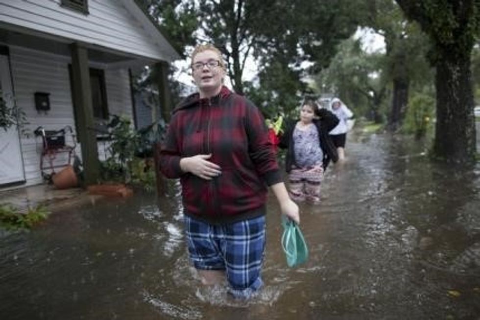
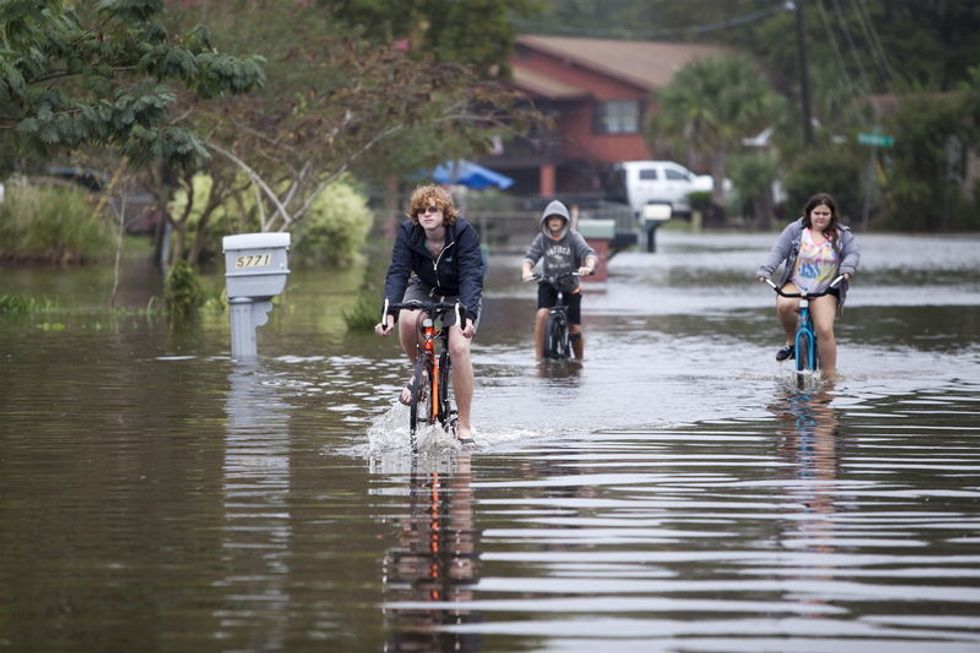
Photo: Whitney Pond and her sisters check out the flooding along Orange Street in Georgetown, South Carolina October 4, 2015. REUTERS/Randall Hill

Fourteen Dead As South Carolina Gripped By Historic Flooding

Fourteen Dead As South Carolina Gripped By Historic Flooding

By Colleen Jenkins

(Reuters) – South Carolina grappled with the damage wrought by record rainfall, as the death toll from widespread flooding rose to 14 on Tuesday and residents braced for more evacuations in areas near swollen waterways and dams across the state.

Predictions of sunny skies in coming days provided only small comfort. More than 800 people were living in shelters after floodwater forced them from their homes, and officials said new evacuations were likely as several rivers remained above flood stage and dams were being monitored for breaches.

“We are still in the mode that the next 36 to 48 hours will be volatile,” Governor Nikki Haley told a news conference. “Don’t let the sunshine fool you.”

Officials said about 300 state-maintained roads and 160 bridges remained closed. Haley stressed the need for motorists to mind police barricades on flooded roads after reports of people moving the barricades or driving around them.

The governor said she could not yet estimate the cost of the devastation but noted “the damage is going to be heartbreaking for a lot of people.”

More than 2 feet (60 cm) of rain have fallen since Friday in parts of South Carolina, which avoided a hit from Hurricane Joaquin but experienced historic rainfall and flooding due to a combination of weather conditions mostly unrelated to that storm.

Of the 14 people who died, eight drowned and six were killed in weather-related car crashes, the state Department of Public Safety said. The extended rainstorm also was blamed for two deaths in North Carolina.

In the South Carolina capital of Columbia, which experienced its wettest days on record over the weekend, the University of South Carolina announced it was cancelling classes through Friday due to the flooding.

Though floodwater was receding in some places, officials warned people to remain vigilant. Early Tuesday, emergency responders in Orangeburg County pulled three people to safety in a boat after they were surrounded by rushing water from the North Edisto River, the State newspaper reported.

The highest recorded amount of rain in South Carolina was 26.8 inches (68 cm), which fell over several days in an area just east of Charleston, National Weather Service meteorologist Carl Barnes said.

On Tuesday, Barnes said brighter days were ahead.

“The worst has passed us, in terms of rainfall,” he said. “We’ll definitely have sun and some very welcome drying out for the rest of the week.”

(Reporting by Colleen Jenkins in Winston-Salem, North Carolina; Additional reporting by Rich McKay in Atlanta; Editing by Bill Trott and Eric Beech)

Restrictions To Remain For Rivers Hardest Hit By Colorado Mine Waste Spill

Restrictions To Remain For Rivers Hardest Hit By Colorado Mine Waste Spill

(Reuters) – Two rivers in Colorado and New Mexico hit hardest by toxic waste spilled from a defunct gold mine will remain closed to drinking water and irrigation intakes for at least another week, but test samples show a gradual ebbing of contamination, environmental officials said on Tuesday.

The San Juan River and its northern tributary, the Animas River, have been fouled by the release of more than 3 million gallons (11.3 million liters) of acid mine drainage inadvertently triggered by a team of Environmental Protection Agency workers last Wednesday.

The discharge has continued to flow at the rate of about 500 gallons (1,900 liters) a minute from the site of the century-old Gold King Mine, near the town of Silverton in southwestern Colorado, into a stream below called Cement Creek.

From there, the wastewater has washed into the Animas River and into the San Juan River in northwestern New Mexico.

Some residents who live downstream from the mine and draw their drinking supplies from private wells have reported water discoloration, but there has been no immediate evidence of harm to humans, livestock or wildlife, according to EPA officials.
Still, residents were advised to avoid drinking or bathing in well water, and the government was supplying water where needed. Two Colorado municipalities, including Durango, and the New Mexico towns of Aztec and Farmington have shut off their river intakes.

The bright orange contamination plume, containing heavy metals such as arsenic, mercury and lead, has dissipated through dilution as the discharge spreads downstream, with its leading edge no longer visible from aerial surveys, the EPA said.

“As it moves on, we are seeing a downward trajectory toward pre-event conditions,” EPA chief Gina McCarthy said at a clean-energy event in Washington.

The Animas River in Durango, about 50 miles (80 km) south of the spill, had turned from orange to bright lime green by Sunday, and was a darker shade of blue-green by Tuesday, a sign that pollutants were gradually clearing, at least near the surface, said Sinjin Eberle, a spokesman for the conservation group American Rivers.

But experts said a long-term concern was the deposit of heavy metals from the spill that had settled into river sediments, where they can be churned up and unleash a new wave of pollution when storms hit or rivers run at flood stage.

POSSIBLE LEGAL ACTION AGAINST EPA

EPA officials said the Animas and San Juan rivers would remain closed until at least next Monday to such uses as drinking, irrigation, fishing and recreation as experts try to gauge safety risks posed by the spill.

Wastewater still escaping from the mine site was being diverted into hastily built settling ponds where the effluent is treated before it empties into Cement Creek, sharply reducing its acidity and metal levels, the EPA said.

Water samples taken from the upper Animas as the main plume of contamination arrived days ago showed concentrations of copper, zinc and cadmium as high as 100 times levels considered safe for fish and aquatic insects, said William Clements, an eco-toxicologist at Colorado State University who reviewed preliminary EPA data.

He said the peak cadmium levels were roughly 10 times higher than what would be regarded as safe for humans, while arsenic – especially toxic to people – spiked at 1,000 parts per billion, he said. That is 100 times the maximum contaminant level for arsenic set by the EPA for drinking water.

Clements said the readings offered just a snapshot of contamination in a place relatively close to the spill’s origin at a point when the effect was most pronounced. “They really do fluctuate quite a bit with time,” he said.

New Mexico Governor Susana Martinez and Colorado Governor John Hickenlooper both declared states of emergency on Monday, freeing up additional money for disaster response. Martinez also said she was directing her administration to “be prepared to take legal action against the EPA.”

Hickenlooper visited a trout hatchery on Tuesday near Durango, where wildlife officials had caged more than 100 juvenile fish at several locations along the Animas to monitor their health. Only one had died so far, officials said.

Utah State University ecologist Charles Hawkins said the health effects on fish could take weeks or months to become lethal, or might translate into reproductive damage. “It would have to be incredibly toxic to kill them immediately,” he said.

The Navajo Nation has also been affected. Tribal communities along the San Juan, which crosses the sprawling reservation through southeastern Utah before flowing to Lake Powell, rely on the river for fishing, irrigation and watering of livestock.

“We intend to make sure the Navajo Nation recovers every dollar it spends cleaning up this mess and every dollar it loses as a result of injuries to our precious Navajo natural resources,” tribal President Russell Begaye said.

(Reporting and writing by Steve Gorman in Los Angeles; Additional reporting by Keith Coffman from Denver and Valerie Volcovici from Washington; Editing by Peter Cooney)

Photo: Yellow waste water that had been held behind a barrier near the abandoned Gold King Mine is seen in the Animas River in Durango, Colorado, in this picture from the Colorado Parks and Wildlife Department taken August 8, 2015. (REUTERS/Colorado Parks and Wildlife Department/Handout)